Data links
Additional information
View additional metadata
- Added to data.gov.uk
- 2026-03-09
- Access contraints
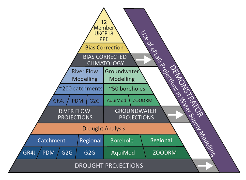
- If you reuse this data, you should cite: Hannaford, J., Mackay, J., Ascott, M., Bell, V., Chitson, T., Cole, S., Counsell, C., Durant, M., Facer-Childs, K., Jackson, C., Kay, A., Lane, R., Mansour, M., Moore, R.J., Parry, S., Rudd, A., Simpson, M., Turner, S., Wallbank, J., Wells, S., Wilcox, A. (2022). Hydrological projections for the UK, based on UK Climate Projections 2018 (UKCP18) data, from the Enhanced Future Flows and Groundwater (eFLaG) project. NERC EDS Environmental Information Data Centre https://doi.org/10.5285/1bb90673-ad37-4679-90b9-0126109639a9
- Harvest GUID
- 1bb90673-ad37-4679-90b9-0126109639a9
- Extent
- Latitude: 60.861° to °
- Longitude: -8.648° to 1.768°
- Spatial reference system
- Dataset reference date
- 2022-01-26 (publication)
- Frequency of update
- Responsible party
- (author, publisher, custodian, owner, pointOfContact); HR Wallingford (author)
- ISO 19139 resource type
- dataset
- Metadata language
- eng
- Source Metadata
- XML
- HTML
Contact
Freedom of Information (FOI) requests
UK Centre for Ecology & Hydrology enquiry service Freedom of information requests for this dataset